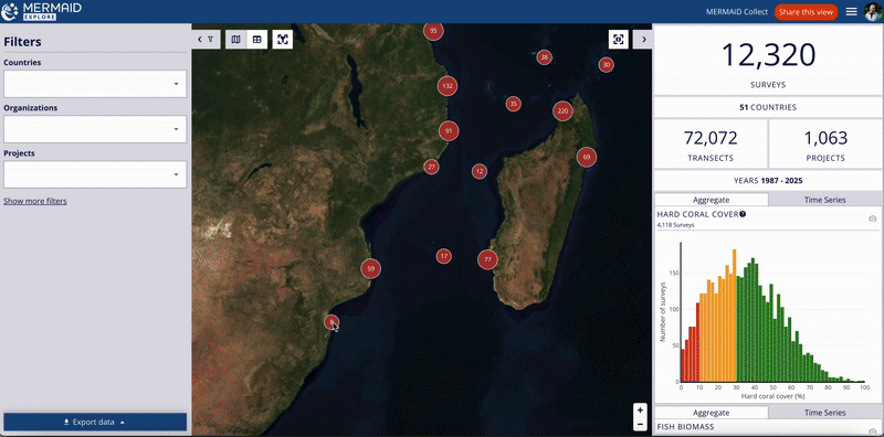
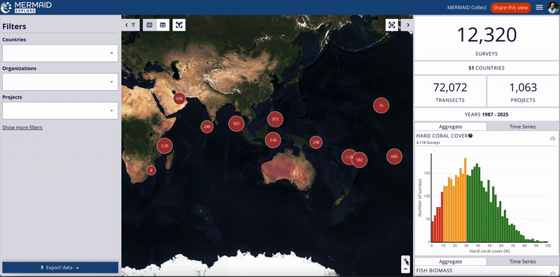
Explore’s map displays MERMAID survey data globally. Red circles indicate survey clusters.
Navigate: Pan by clicking and dragging. Zoom using the +/- buttons, trackpad, mouse scroll, or by clicking on the red cluster circles.
Site Details: Click repeatedly on clusters to zoom down to individual site markers (pins). Clicking on a site marker opens the right-hand metrics panel displaying detailed information about surveys at that specific site. This panel includes:
Site, followed by the Site Name.
Below that, the Project section shows the Project Name, along with icons to contact project admins and an export icon. Clicking this icon exports a file with project metadata (such as project admins, number of sites and surveys, data sharing policies, etc.) and survey data itself (depending on the data sharing policies). (Note: See the Exporting Data section for details on data export based on filters, across multiple projects and data sharing policies)
The Survey Date section lists the relevant date(s).
Two tabs allow you to switch between views:
A Summary tab showing relevant visualizations for that site’s data.
A Metadata tab containing details like Management Regime, Admins (with contact icon), Reef Habitat (Zone, Type, Exposure), Data Sharing status, and the Suggested Citation for the data.
Click on the X in the top-right corner of this panel to close the site-specific view and return to the overall summary metrics and charts.
Map-Based Metrics (Optional): By default, the main summary metrics panel (visible when no specific site is selected) updates based on filters. To update metrics based on the visible map area instead, enable the Metrics update based on map view toggle (looks like a refresh icon ) next to the right-hand panel. Disable it to return to filter-based metrics.